Natalie and I visited Acadia National Park for 2 days at the beginning of June (June 6th and June 7th). While the weather was generally overcast and drizzly, the rain let up now and then and the sun poked through at the climax of our big hike for the trip: Jordan’s Pond Loop with South Bubble Spur.
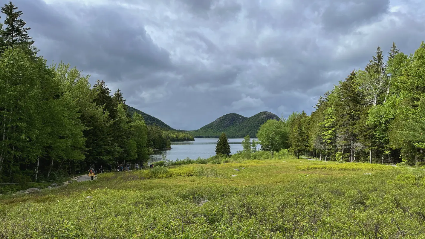
The Jordan’s Pond Loop is an easy 5km (3.1mi) hike around the placid lake. Most visitors, ourselves included, start and end the loop at the Jordan’s Pond tea house. The tea house is known for serving blueberry popovers and tea, from a nice tea room (or lawn if the weather permits) with a gorgeous view of Jordan’s Pond stretching out to “The Bubbles”. If you have the time, I would highly recommend stopping in after your hike to enjoy the view and the atmosphere.

BE WARNED: While we were at Acadia on the early side of the season, it was already busy and parking was hard to come by. I imagine during the height of the season the tea house, and all of Acadia, will be packed.
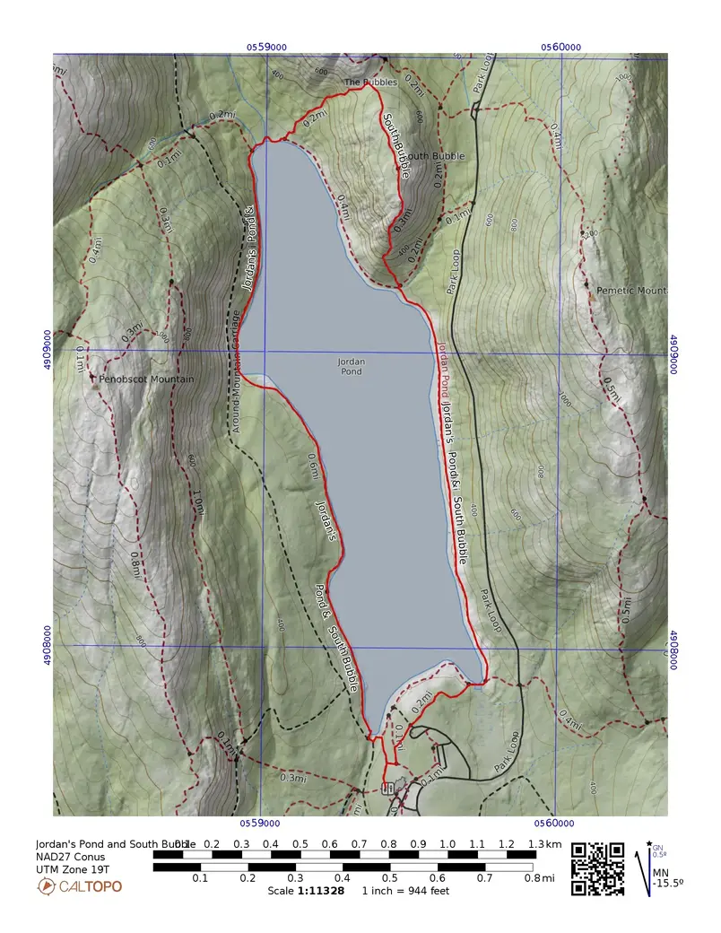
The Jordan’s Pond Loop is a great family hike and good for beginners. Going counterclockwise or clockwise doesn’t matter for the basic loop. To make the hike a bit more interesting we decided to add a quick detour up and down South Bubble. It was more strenuous than anticipated, but worth it! The view from South Bubble is amazing. This added an extra 0.77km to our hike. I would classify the hike with the spur as moderate. Here is a map of the route:

Both a gpx track and a pdf version1 of the map are available.
Instead of being completely flat the hike up South Bubble added an extra 171m (562’) elevation gain.

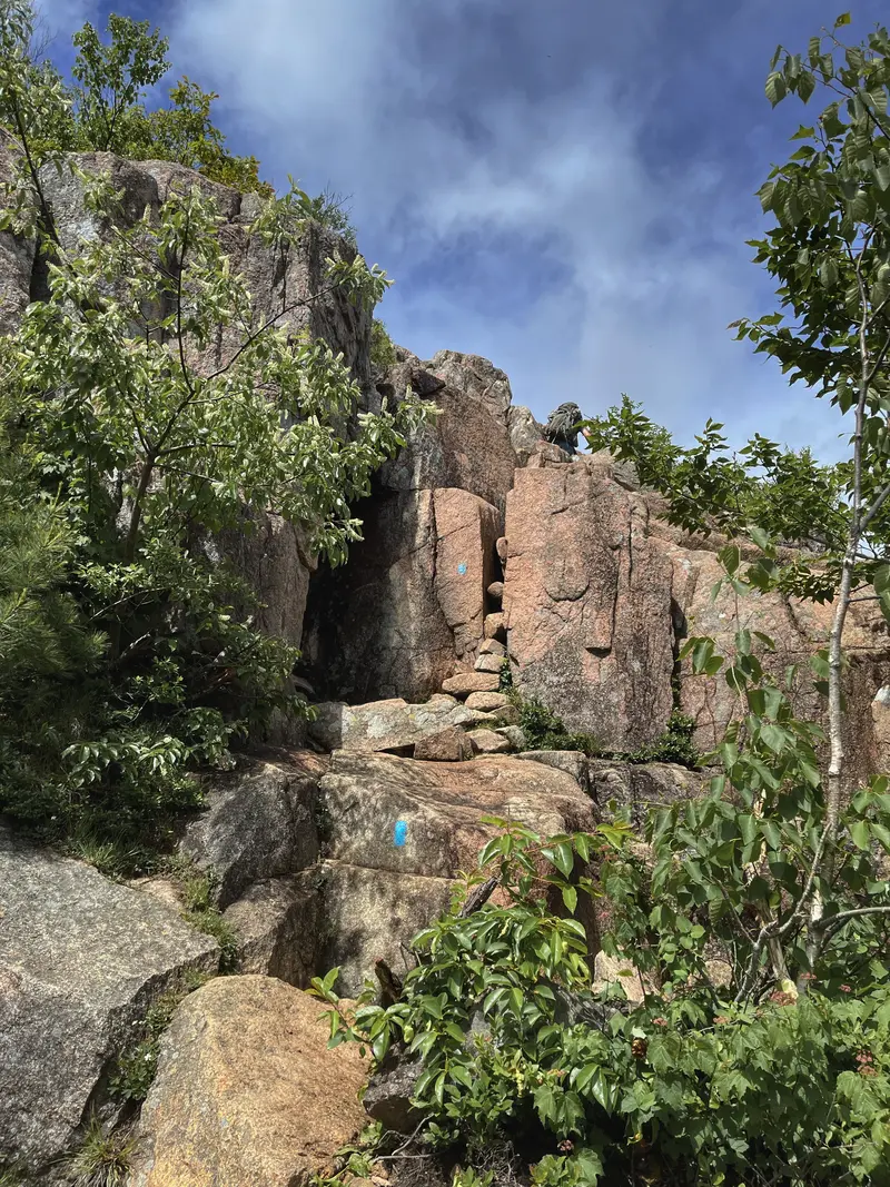
We did our hike clockwise around the lake, which led us to ascend South Bubble from the north and descend the south face. Mistake! If completing this loop with the spur, I would suggest going counterclockwise: ascending the south face and descending on the north side. One can tell by the elevation profile that the south face is much steeper. It’s mostly a very steep rock scramble down (I think it’d be much easier to go up). And for those asking, on and off trail, NO. Your dog cannot make it up the rock scramble on the south face.

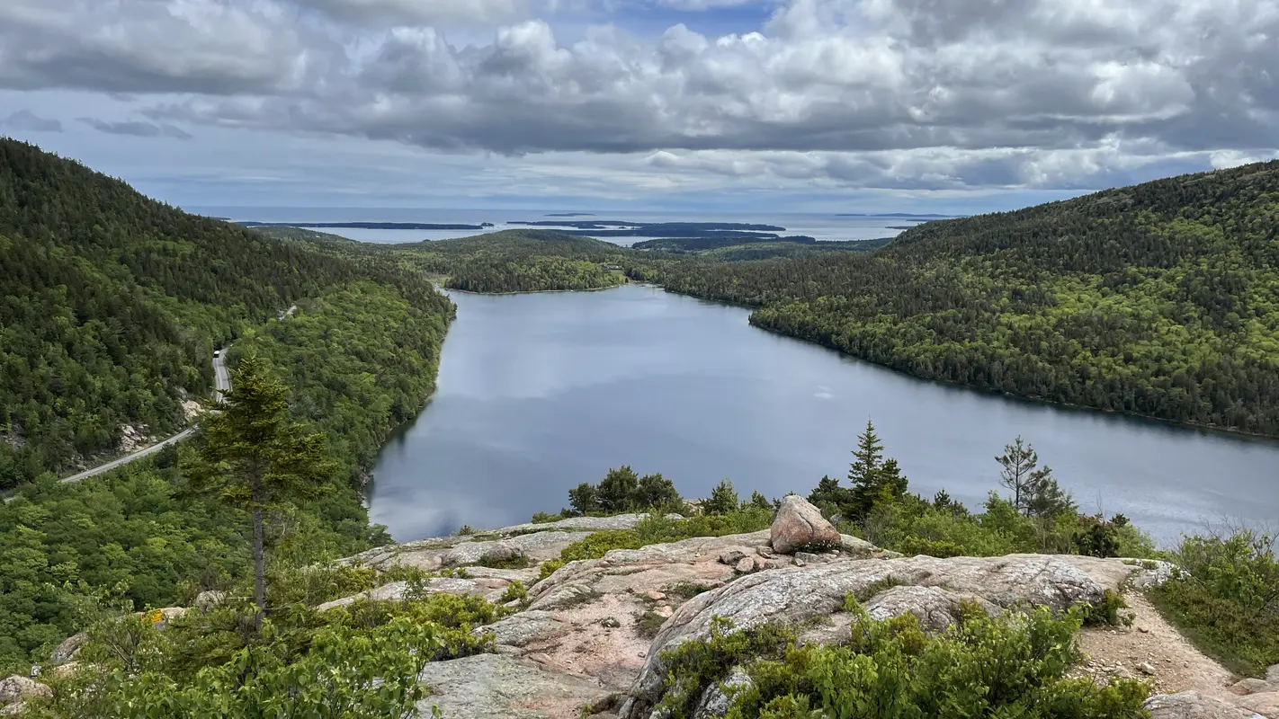
Although we took the difficult route down, the spur was/is 100% worth it. The view from the top is gorgeous. (The bubble itself is meh, it’s just a precarious rock.) It lays out Jordan’s Pond which guides your eyes to the ocean and islands beyond. The majority of our hike was cloudy and drizzly, but the sun came out and the weather cleared just as we reached the summit of the bubble.

The Jordan’s Pond Loop with South Bubble spur is a great hike of moderate difficulty. It can be completed relatively quickly, leaving you time for another hike in the same day. The views are amazing, and finishing the hike up with tea and popovers is a real treat. Would definitely recommend, 6/10 hike2.